Lanzhou, March 12 (Xinhua) -- Based on satellite remote sensing data and ground observation data, Professor Huang Jianping, director of the Collaborative Innovation Center for Ecological Security in western China, Lanzhou University, and his team successfully built a global desertification vulnerability index for five years and used numerical simulation to predict the evolution trend of desertification risks in the future. The index can be used to assess global vulnerability to desertification and is of great significance to policy makers in developing policies for land restoration and desertification control in sensitive areas and provides a scientific basis for global desertification control.

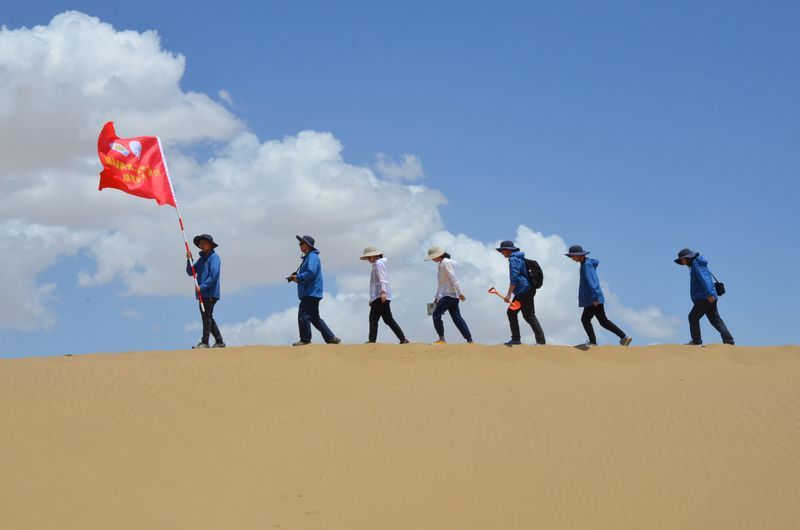
Huang jianping's team is conducting field research in the Taklamakan desert. Contribution from interviewees
Desertification is not only a serious threat to global ecological and environmental security, but also affects global economic development and the sustainable development of human society, Huang said. At present, more than 100 countries and regions with desertification problems have reached 36 million square kilometers, accounting for one sixth of the global population, which is directly threatened by desertification. "Therefore, the risk assessment of desertification is of great significance. We can take preventive measures before the damage happens to reduce the damage caused by desertification disasters."
According to the report, the process involved in desertification is relatively complex. Previously, scholars at home and abroad have done a lot of research on the assessment of desertification. In the early stage, it is mostly based on ground survey to assess the desertification status of a certain area. Although ground survey can obtain more accurate data, its research space scope is limited, and there are some limitations in large-scale desertification monitoring. With the development of satellite remote sensing technology, desertification monitoring is developing towards quantitative remote sensing.
Huang jianping told reporters that the team's main progress is to use human activity intensity index and climate environment index to build an assessment system suitable for assessing global desertification risk, assess the current global desertification risk distribution, and predict the evolution characteristics of global desertification risk under different scenarios in the future.
The research results of the team show that the GLOBAL desertification vulnerability Index can divide the global desertification vulnerability into four grades: extremely high, high, medium and low under the same index system. Currently, areas with medium, high and very high desertification risks account for 13%, 7% and 9% of the global area respectively. The study also predicts that by the end of this century, due to climate change and human activities, the proportion of the global area at risk of desertification in areas of medium and above will increase by about 23% under future high-emission scenarios, with increased desertification risks mainly in northern China, Africa, North America and India.
Since desertification risks in most regions are caused by a combination of climate change and human activities, the team suggests that to prevent further expansion of desertification in the future, the degree of direct human interference with the environment needs to be reduced and climate change mitigation policies adopted accordingly.
The reporter learned that the relevant research results of the team were recently published in the internationally renowned journal "Land Degradation and Development". (after)


